 |
| Looking west at the setting full moon, Yarnell |
Life can be a lot sometimes, especially because I have some challenges (as they say) with saying “no.” I can get frustrated when there’s not enough time to do the epic road trip for photography.
But there is, in fact, plenty of beauty and interest right here at home in Southern Yavapai County, Arizona. I write this blog as much to remind myself of this fact as anything else.
 |
| The incident Site, the turn-around point on the Memorial Trail |
 |
| Spring sunrise on the Memorial Trail |
After the tragic Yarnell Hill Fire in June 2013, the Granite Mountain Hotshots Memorial Trail was built, through some of the burned area. The trail ends in what’s come to be called the incident site, where the 19 hotshot firefighters lost their lives. In addition to the emotional content on this hike, there are striking views.
 |
| The old stairs at the overlook, Yarnell Hill |
Yarnell Hill used to be the main road north from Phoenix, and before the new northbound lanes went in in the 1970s it was apparently a rather harrowing drive. Points of interest on the road include a historic overlook, the trailhead for the Memorial Trail, and the Elephant Curve (come on up and see that one for yourself.) I have a project in mind which would entail “then and now” photos using ADOT’s archives on Yarnell Hill.

Old bridge over the Hassayampa River on Wagoner Road
Just north of is a fascinating drive up Wagoner Road. If you’re patient and have a sturdy vehicle,
it’ll get you to Crown King or, eventually, to the Senator Highway in
Prescott. One of the highlights of that
drive is the 1920s era bridge over the Hassayampa River. The cottonwoods in the riverbed are
especially impressive in Spring and Fall.

Alamo Peak and Stanton from "Cell Phone Hill"
 |
| Layers to the south of "Cell Phone Hill" |
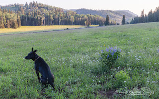
There’s a small hill on the East side of Yarnell which is accesses by a bumpy two-track. It offers breathtaking views of nearby Antelope Peak above and Stanton and Congress below. Mostly this is one of my favorite short dog hikes, but occasionally I also make it up there with my camera.
 |
| Clearing storm over Rocky Boy mountain, Peeples Valley Arizona |
Peeples Valley is the next town up the road from Yarnell. The two communities are one in many ways, but it has more of a agricultural feel, with larger lots and large tracts of land owned and grazed by Maughan Ranches.

Sunrise aerial of Hidden Springs Ranch, Peeples Valley
 |
| Autumn color at the tree tunnel, Hidden Springs Ranch, Peeples Valley |
The 225 acre Hidden
Springs Ranch raises and trains racehorses.
It is strikingly photogenic, especially at the cottonwood tree tunnel
that frames the entrance to the property.
 |
| Skull Valley Gas Station in selective color |
 |
| Turkey Vulture, Yarnell Arizona |
 |
| Great Horned Owl guarding its nest, Peeples Valley Arizona |
We’re famous for Turkey vultures, though here in the country we’re more likely to call them buzzards. There is much more wildlife, though, including mule deer, bobcats, mountain lions, foxes, javalina, Skunk, racoon, and an annoying assortment of rodents, which supports an array of raptors. One day I’ll get serious about camera trapping photography for wildlife in town.
 |
| Arizona Poppies in monsoon season along Highway 89 |
 |
| Claret Cup Cactus, Yarnell Arizona |
And, of course there are flowers.

Clearing winter storm, Yarnell Arizona 
Abstract snowy scene, Yarnell Arizona
It snows up here, and I love rolling out of bed, pulling on the muck boots, and shooting the odd, lovely morning light after a storm.
Thanks for hanging out at home with me today. There’s more
in the Yavapai
County Gallery on the website.


